File:Sydney harbour bridge night.jpg
Jump to navigation
Jump to search

Size of this preview: 800 × 246 pixels. Other resolutions: 320 × 99 pixels | 640 × 197 pixels | 1,024 × 315 pixels | 1,280 × 394 pixels | 4,856 × 1,495 pixels.
Original file (4,856 × 1,495 pixels, file size: 964 KB, MIME type: image/jpeg)
Captions
Captions
Add a one-line explanation of what this file represents
Summary
[edit]
| Description |
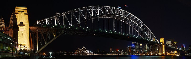
English: Sydney Harbour Bridge at night, taken near Luna park and Milson's point ferry.
Français : Vue nocturne du pont du port de Sydney (Sydney Harbour Bridge), vu d'un point près du Luna Park et du Ferry de Milson's point. |
| Date | |
| Source | Own work |
| Author | Antilived |
| Camera location | | View this and other nearby images on: OpenStreetMap |
|---|
Licensing
[edit]
I, the copyright holder of this work, hereby publish it under the following licenses:

|
Permission is granted to copy, distribute and/or modify this document under the terms of the GNU Free Documentation License, Version 1.2 or any later version published by the Free Software Foundation; with no Invariant Sections, no Front-Cover Texts, and no Back-Cover Texts. A copy of the license is included in the section entitled GNU Free Documentation License. |
| This file is licensed under the Creative Commons Attribution-Share Alike 3.0 Unported license. | ||
| ||
| This licensing tag was added to this file as part of the GFDL licensing update. |
This file is licensed under the Creative Commons Attribution-Share Alike 2.5 Generic, 2.0 Generic and 1.0 Generic license.
- You are free:
- to share – to copy, distribute and transmit the work
- to remix – to adapt the work
- Under the following conditions:
- attribution – You must give appropriate credit, provide a link to the license, and indicate if changes were made. You may do so in any reasonable manner, but not in any way that suggests the licensor endorses you or your use.
- share alike – If you remix, transform, or build upon the material, you must distribute your contributions under the same or compatible license as the original.
You may select the license of your choice.
This image has been assessed using the Quality image guidelines and is considered a Quality image.
|
File history
Click on a date/time to view the file as it appeared at that time.
| Date/Time | Thumbnail | Dimensions | User | Comment | |
|---|---|---|---|---|---|
| current | 03:24, 21 February 2007 | 4,856 × 1,495 (964 KB) | Antilived (talk | contribs) | corrected more lens flares | |
| 07:32, 17 February 2007 | 4,855 × 1,494 (1.33 MB) | Antilived (talk | contribs) | corrected geocode data | ||
| 06:45, 17 February 2007 | 4,855 × 1,494 (1.33 MB) | Antilived (talk | contribs) | geocoded and added the original exif data back | ||
| 05:16, 15 February 2007 | 4,855 × 1,494 (1.32 MB) | Antilived (talk | contribs) | {{Information |Description=Sydney Harbour Bridge at night, from North shore near Luna park and Milson's point ferry |Source=Own work |Date=2007-02-06 |Author=Antilived |Permission= |other_versions= }} Category:Sydney Harbour Bridge |
You cannot overwrite this file.
File usage on Commons
The following 6 pages use this file:
- User:Antilived
- User talk:Antilived
- Commons:Featured picture candidates/Image:Sydney harbour bridge night.jpg
- Commons:Featured picture candidates/Log/March 2007
- Commons:Quality images/Subject/Places/Man made structures/Panorama/archive 2008 to 2013
- Commons:Quality images candidates/Archives March 2007
File usage on other wikis
The following other wikis use this file:
- Usage on en.wikipedia.org
- Usage on fr.wikipedia.org
- Usage on jv.wikipedia.org
- Usage on sv.wikipedia.org